Groundwater Geophysics
The ever-increasing need for groundwater has translated into using subsurface imaging to meet the demand. Generally, the methods applied to find groundwater are very similar to those used for natural resource exploration for mineral or petroleum products. However, new geophysical equipment specifically for shallow ground characterization is being developed constantly and we stay on the cutting edge of this development. Groundwater projects conducted by Olson are typically in the upper 1000 feet of the ground surface, and can largely be categorized in one of three settings:
- Unconfined aquifer investigations in shallow unconsolidated alluvial deposits where saturated porous-media flow is the target.
- Confined aquifer investigations in which the target is characterizing the geometry of the aquifer and aquitard layers.
- Confined groundwater investigations targeting secondary flow pathways caused by faults, fracture systems (or a combination), or karst, all of which are based on the geologic structure beneath the site.
Each of these hydro-geologic settings have unique characteristics that require close collaboration with our clients to understand their need for yield and quality yet remain within the limits of the water-rights permitted to that site. The geologists and geophysicists at Olson Engineering have experience working in all three hydro-geologic scenarios, allowing us to design a geophysical survey to meet your objective.
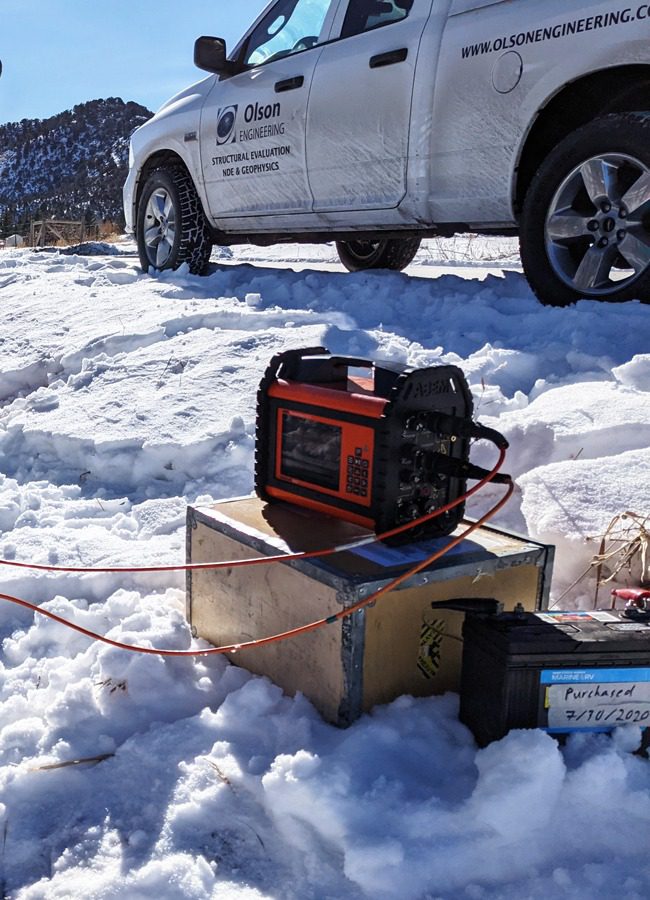
Unlike Engineering or Environmental projects, geophysical groundwater projects tend to be more complex, yet require less resolution or precision in the measurements. For example, detection of a fault at a depth of several hundred feet, does not require the precision in the measurements that is required to design a bridge foundation. Therefore, the projects often cover broad areas that may include an entire valley or mountainside, and as such, the team must have a good understanding of the geologic structure. Large-scale USGS maps can guide the geophysical program design, in most cases, but a greater understanding of the site conditions by our clients leads to the: choice of the method(s), survey design, and data acquisition parameters. These are all critical to success of the survey, except for the presence of water, of course.
In most circumstances, more than one method is required to effectively determine where to drill a test hole, or a production well. In general, the detection of a fault, or series of faults, is not difficult (using seismic), but determining if water exists along those structures requires applying EM or ER survey techniques. Seismic cannot alone determine the presence of water, and EM or ER are not effective at imaging structures. We have the capability with this combined-method approach to target both the structure and presence of water. This approach then allows a prediction for the presence of (fresh) groundwater and anticipated depth to intersect structure(s) or water-bearing formations (i.e., aquifers). In unconsolidated alluvial settings, the method selection is determined by the objective of finding the overall thickness of the soil deposits, or determining the presence of impermeable clay layers and/or lenses or permeable sand and gravels.
Aquifer Storage Recharge (ASR) is a burgeoning approach to storing groundwater in the porous alluvial deposits in the valley floor of large river drainages. Olson has helped with defining bedrock characteristics in order to understand the lateral continuity of the surface, its character and quality, as well as aid in the design of the cut-off wall for: depth to the bedrock surface to ensure positive cutoff, avoid obstacles (e.g., landfill materials or indurated soil deposits), and continuity of known soil conditions. Geophysics is a valuable tool to ASR, as drill holes alone cannot cover the entire area impacted by the storage of water below the ground surface.
For groundwater investigations, Olson has worked with clientele ranging from home owners to hydrologic consulting companies, as well as municipalities. Due to this wide range of clients, we tailor the scale of work and the complexity of the survey to meet the clients’ desire. For example, is the purpose of the groundwater investigation to produce a 10 to 15 gpm well for residential consumption, or construction of multiple wells for a high-yield groundwater well field? Similarly, in unconsolidated / unconfined aquifer settings, meeting the need for a single well or aiding in the design of a shallow alluvial gallery is the advantage geophysical imaging provides hydrologists. Understanding the yield you need from groundwater resources beneath a site dictates how Olson approaches the finding of drilling target(s).
Applications for Geophysical Groundwater Exploration
Depth to bedrock / Thickness of alluvium
Lithology for sand & gravel deposits versus clay layers
Depth to water table (in saturated, course-grained soils)
Lateral extent of alluvial deposits for infiltration galleries
Presence of paleochannels, to identify where bedrock deepens abruptly
Fault and its antithetic features (e.g., graben)
Fractures in bedrock
Depth to aquatard
Depth to known aquifer formation(s)
Difference of saline/brackish water versus fresh groundwater
Saltwater intrusion in coastal aquifers
Aquifer Storage Recharge (ASR) delineation